
A fitness app called Strava updated the 2017 exercise routes of more than one billion people over the weekend.
In the process, Strava may have inadvertently revealed the locations and activities of US troops in secret bases around the world.
The Strava app takes data from fitbits and smartphones, uploading the information to a “heatmap” for users to track their workouts and share with friends.
People from all around the world use the app, and could prove problematic for a number of foreign militaries. But since the app is used mostly by young westerners, the US military has the most to lose, given its large global footprint.
Here are 10 of the most revealing images from the heatmap:
These look like US outposts outside of Mosul, Iraq.

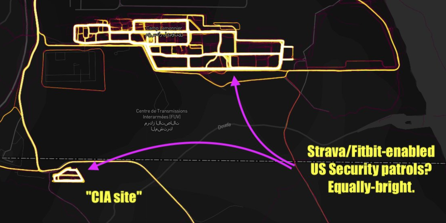
Here's Camp Lemonnier, a US military base in Djibouti, along with a possible CIA site nearby.

There's noticeable activity around a reported CIA annex at the Mogadishu airport in Somalia.

Via Daily Beast reporter Adam Rawnsley
Check out this activity around a US military outpost called Al-Tanf in Syria.

Unclear activity in Yemen's Al Jawf governorate, where the US supports the Saudi-led coalition fighting the Iranian-backed Houthis, and is also conducting airstrikes against Al-Qaeda.

There's no activity, however, in the Pentagon.

It's not just the US that's been affected. Here's Russia's Humaymim Air Force base in Latakia Governorate, Syria.

A French military base in Niger.

You can clearly see Turkish patrols in Manbij, Syria, which are waging a new campaign against the US-backed SDF.

Faint data on Woody Island in the South China Sea likely shows Chinese forces on the disputed island.
