
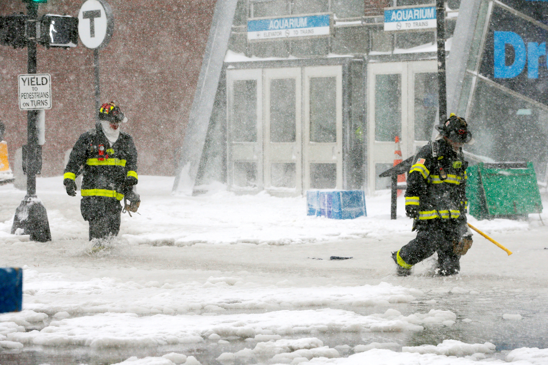
After a massive Nor’easter hit Boston, Massachusetts on Thursday, water flooded the city’s downtown.
The icy floodwater submerged roads, forced some people to evacuate their residences, and prompted first responders to rescue those trapped in their cars.
And on Friday morning, some residents of Revere, Massachusetts – a Boston suburb – woke up to their cars frozen in ice.
Adam Abougalala, who lives in Revere, posted the following video, which shows frozen water that reached the wheel wells of cars parked along the street.
https://twitter.com/Adam28691/status/948997646852808704?ref_src=twsrc%5Etfw
Around 20 residents evacuated their homes, and some needed to be rescued with the help of high-water vehicles provided by the National Guard, according to The Boston Globe.
Though it's too early to tell exactly how much floodwater swept the city, the water appeared to have risen at least two feet in some areas on Thursday. The storm also partially broke a sea wall and affected the power grid in Plymouth, a coastal town south of Boston.
On Thursday afternoon, the tide gauge at Boston Harbor reached 15.16 feet. The previous record was set during the blizzard of 1978, according to The National Weather Service.
A picture taken by a resident as a DXFD FF makes their way through deep water to assist a resident. #DXFD pic.twitter.com/shlWS3eR0S
— Duxbury Fire PIO (@DXFD_PIO) January 4, 2018
On Thursday, Boston resident and Twitter user @kelkelly posted a video of the scene in the city's Fort Point neighborhood. A dumpster can be seen floating down a flooded road:
https://twitter.com/kelkelly/status/948982158533824512?ref_src=twsrc%5Etfw
Kasey Holbrook, another Boston resident, took this video of the city's Scituate Harbor:
Video of the Scituate Harbor - it's a swirly, icy messy. Credt: Kasey Holbrook pic.twitter.com/oclHSep9YB
— Kacie Yearout (@kacieyearout) January 4, 2018
Meteorologists say that the storm is experiencing "bombogenesis," meaning rapid atmospheric pressure has fallen below 24 millibars in less than 24 hours. In other words, the low air pressure is creating an especially strong storm.
Dubbed a "bomb cyclone," the storm is threatening New York, Pennsylvania, Massachusetts, and parts of Rhode Island, Connecticut, and Maine with heavy snow, fast winds, and close-to-zero temperatures until this weekend. Then it will make its way to the Canadian Maritimes, sitting over Nova Scotia and New Brunswick.
In Boston, temperatures have dipped below freezing, and it's only expected to get colder. At least 22 people have died this week from severe weather across the US.
Eastern and Central Massachusetts are expected to see 10 to 14 inches of snow and wind gusts of 50 mph to 70 mph. The Boston Police Department tweeted on Thursday that the streets were "completely impassable."
Do not attempt to drive on the flooded roads in town. They are completely impassable and you will get stuck https://t.co/GtcTgH6cXI
— Duxbury Police (@Duxbury_Police) January 4, 2018