
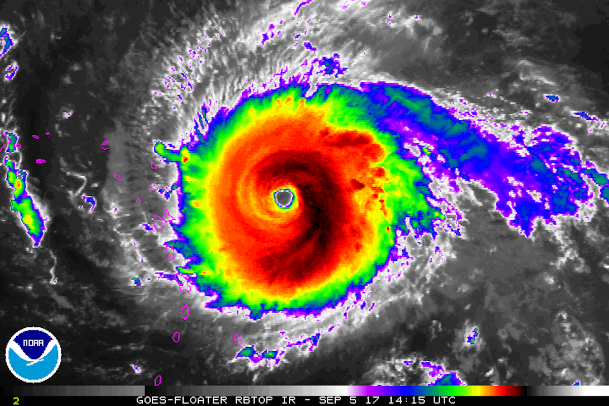
Since Thursday, Hurricane Irma has been gaining strength and is now a Category 5 storm.
That means parts of the hurricane’s core have sustained wind speeds of at least 175 mph, violent enough to destroy homes and overturn trains. There’s also a risk Irma’s storm surge – a crest of water formed before a storm by powerful winds – may reach a height of 11 feet above a typical high tide, though storm-surge levels vary by location.
The National Hurricane Center has issued warnings for the US Virgin Islands, Puerto Rico, and the Dominican Republic, where Irma could strike as early as Wednesday morning. Some hurricane experts say the US Gulf region and East Coast – from Florida to Maine – should prepare.
Several official weather agencies and experts – some known as hurricane hunters – are tracking the storm.
The two largest US organizations tracking the storm, the National Oceanic and Atmospheric Administration's National Hurricane Center and National Weather Service, are providing live updates on their sites and Twitter.
Using data from drones, satellites, radar, and buoys, these organizations are tracking Irma's possible path, wind speeds, heat, and rain levels.
-
Watch as Hurricane #Irma moves towardthe Leeward Islands in this #GOES16 geocolorloop. Get the latest on Irma @ https://t.co/cSGOfrM0lG pic.twitter.com/ixIhkXqVNa
— NOAA Satellites (@NOAASatellites) September5, 2017
Watch as Hurricane #Irma moves towardthe Leeward Islands in this #GOES16 geocolorloop. Get the latest on Irma @ https://t.co/cSGOfrM0lG pic.twitter.com/ixIhkXqVNa
#Irma#GOES16https://t.co/cSGOfrM0lGpic.twitter.com/ixIhkXqVNaSeptember5, 2017
Below are other reputable meteorologists to follow on Twitter who are continually sorting through NHC, NWS, and NOAA data:
- Jeremy Smith, a senior meteorologist at FedEx. Gary Szatkowski, a retired NWS meteorologist. Michael Lowry, a task-force lead with the Federal Emergency Management Agency. Eric Holthaus, a meteorologist and host of the podcast "Warm Regards." Stu Ostro and Rick Knabb, senior meteorologists at The Weather Channel. Philip Klotzbach, a meteorologist at Colorado State University. Michael Ventrice, a meteorological scientist at The Weather Company and IBM.
#Irma's rainbands, eyewall, and eye within radar range... see latest loop at https://t.co/vWICHS7kHl @UMiamiRSMAS @capitalweather pic.twitter.com/mVHdY02Kbr
— Brian McNoldy (@BMcNoldy) September 5, 2017
Alex Pier, a YouTube user, has also made a playlist of webcams livestreaming several areas where Irma could hit. These may show the storm on the ground level.