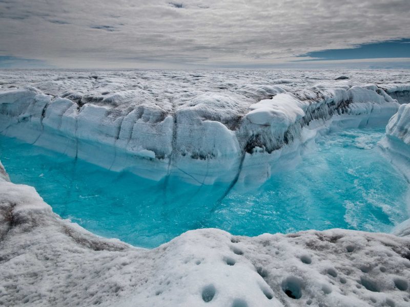
The world’s ocean levels are rising at faster and faster rates as waters warm and ice sheets melt.
Researchers led by Steve Nerem, a professor of aerospace engineering at the University of Colorado-Boulder, looked at satellite data dating back to 1993 to track the rise of sea levels.
Their findings, published in the journalProceedings of the National Academy of Sciences, show that sea levels aren’t just rising – but the increase has been accelerating over the last 25 years.
Even small increases can have devastating consequences, according to climate experts. If the worst climate-change predictions come true, coastal cities in the US from New York to New Orleans will be devastated by flooding and greater exposure to storm surges by the year 2100.
Research group Climate Central has created a plug-in for Google Earth that illustrates how catastrophic an "extreme" sea-level rise scenario would be if the flooding happened today, based on projections in a 2017 report from the National Oceanic and Atmospheric Agency.
You can install the plug-in (directions here) and see what might become of major US cities.
In a worst case scenario, flooding caused by polar melting and ice-sheet collapses could cause a sea level rise of 10 to 12 feet by 2100, NOAA reported in January 2017.
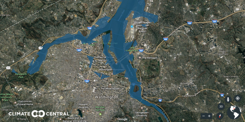
Here's Washington, DC today. The famed Potomac River runs through it.
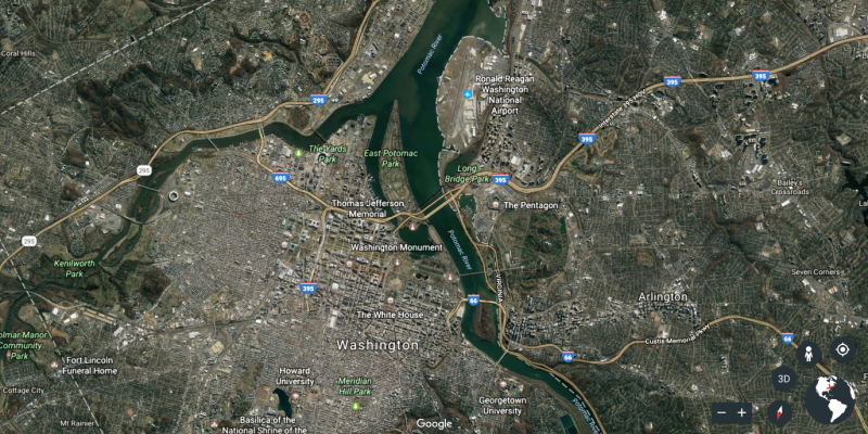
And here's what Washington, DC, might look like in the year 2100 — as seen on Climate Central's plug-in for Google Earth. Ocean water causes the river to overflow.
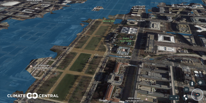
Despite former Press Secretary Sean Spicer's claims, Trump drew modest crowds at his inauguration on the National Mall in January 2017. It sits at the foot of the US Capitol.
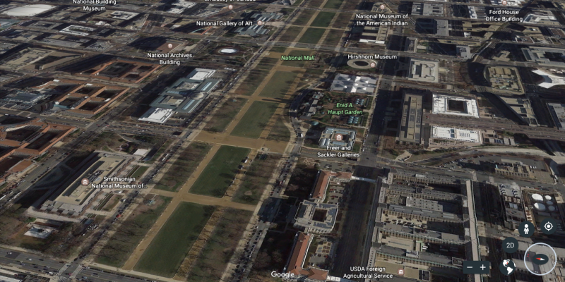
Future inaugurations wouldn't quite be the same.
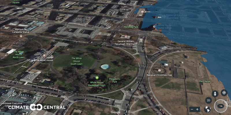
In 2017, President Trump stood outside the White House and announced his intentions to withdraw from the Paris Agreement, a deal between 195 countries intended to mitigate global warming.
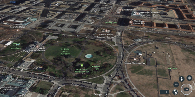
In 2100, the White House's Rose Garden could have an oceanfront view.
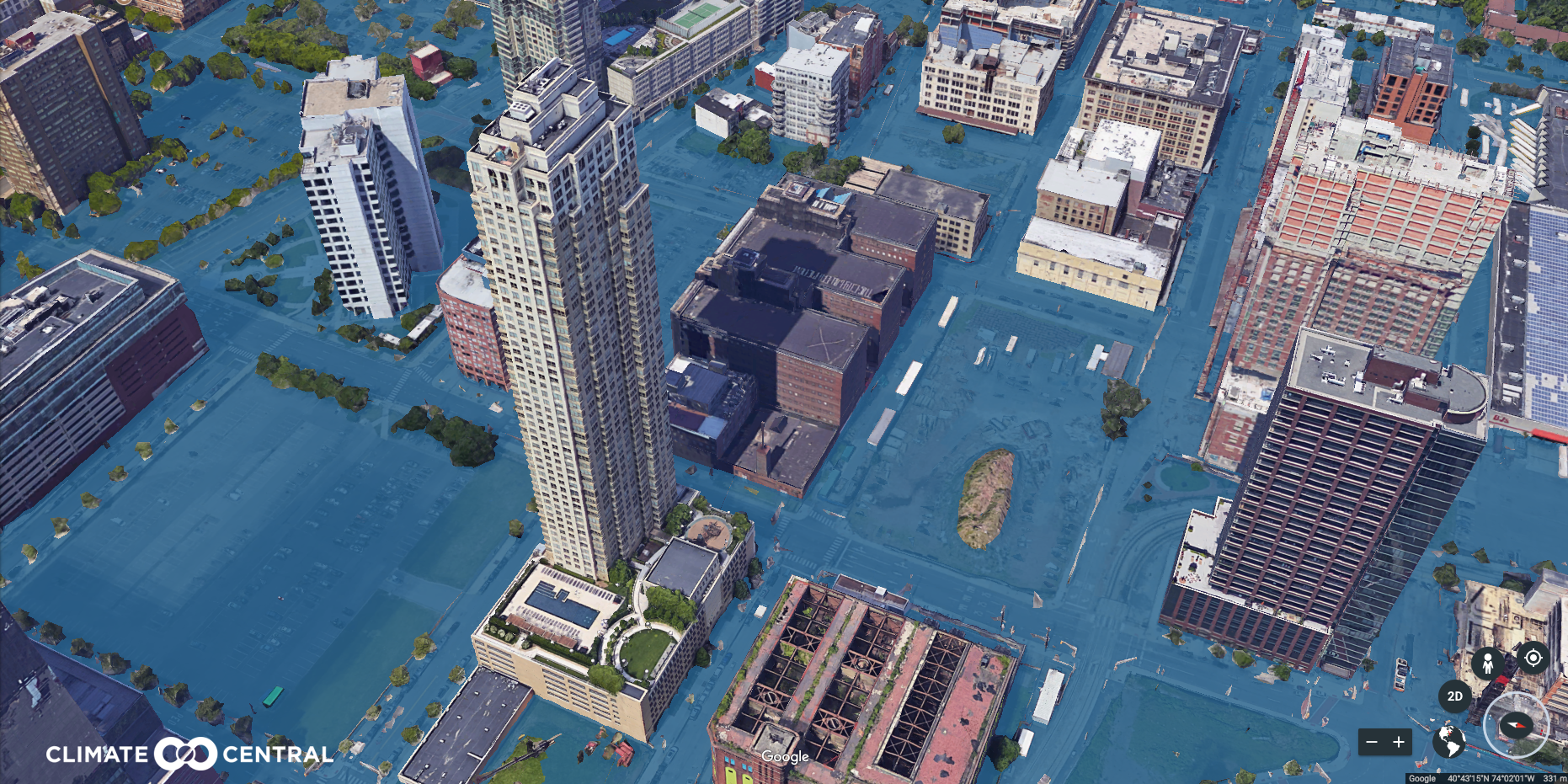
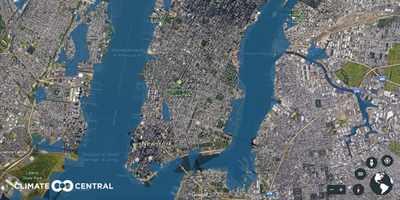
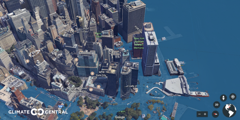
New York City is situated on one of the world's largest natural harbors.
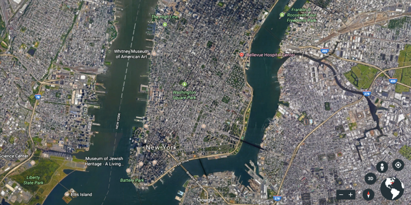
The Hudson River could flood the city's perimeters and low-lying areas like the West Village.
The Financial District encompasses the offices of many major financial institutions, including the New York Stock Exchange and the Federal Reserve Bank of New York.
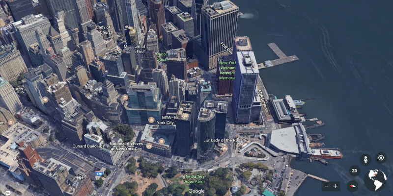
Extreme sea level rise could devastate Wall Street. Battery Park would be a water park.
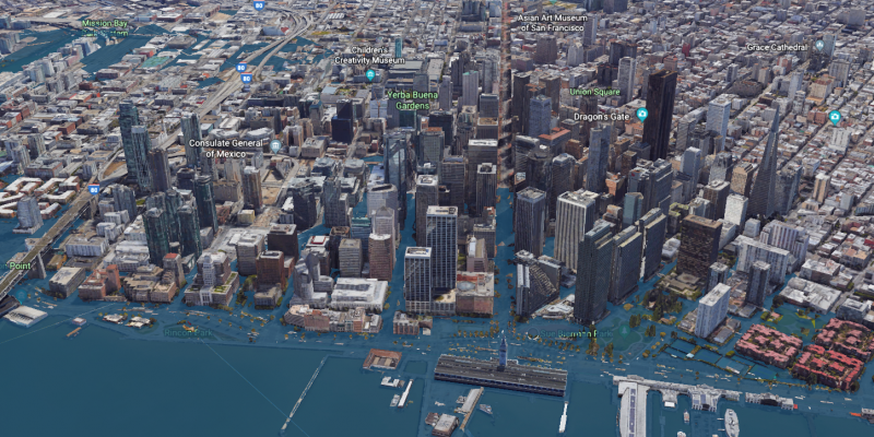
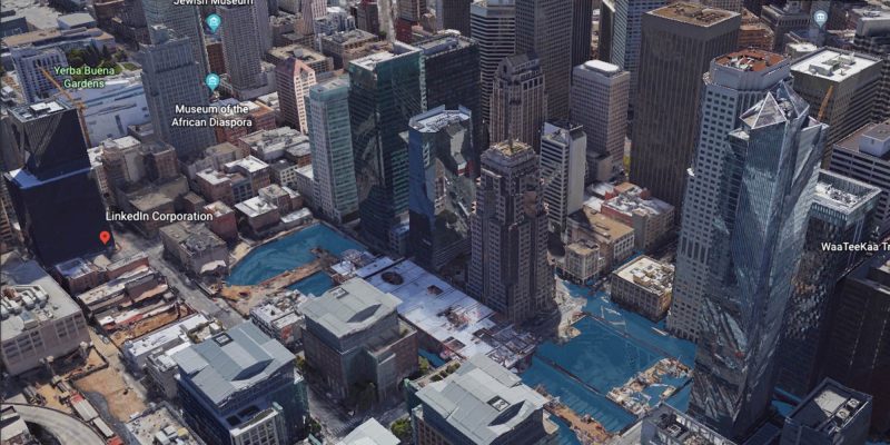
San Francisco has a huge concentration of wealth and power in the technology world.
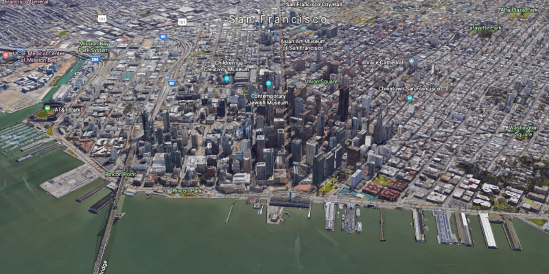
It's also a peninsula that's prone to flooding.
This one swath of downtown has offices for LinkedIn, Business Insider, and Salesforce.
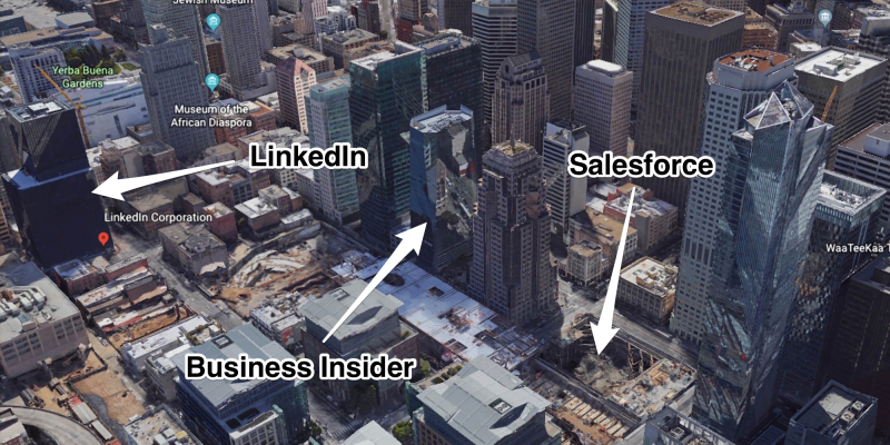
They're located too close to the waterfront to avoid flooding.
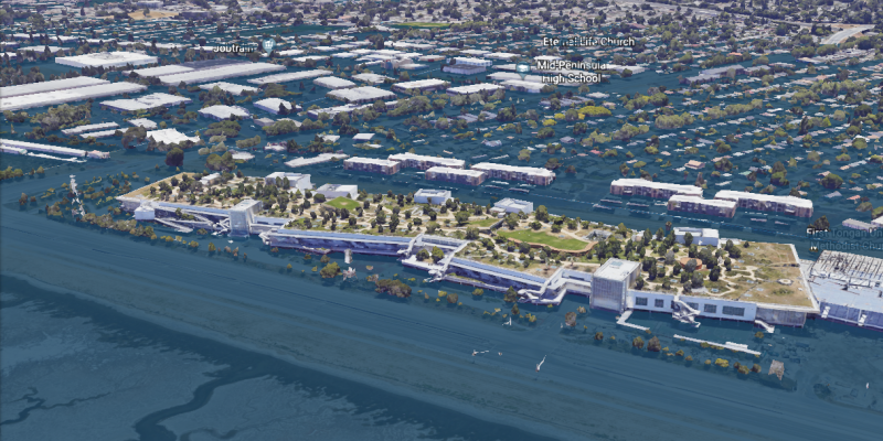
Further south in Silicon Valley, Facebook's campus dazzles in Menlo Park, California.
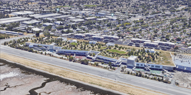
As if the social media giant didn't have enough problems on its hands already, the headquarters could someday be underwater.
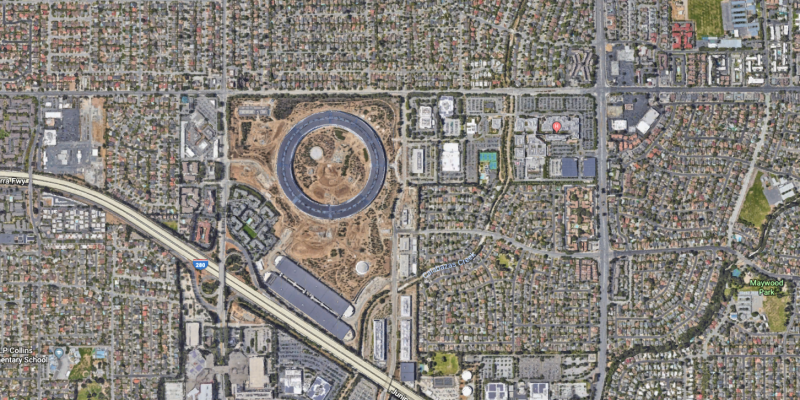
Apple's new campus (the big ring) in Cupertino, California, will stay high and dry.
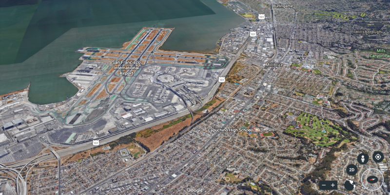
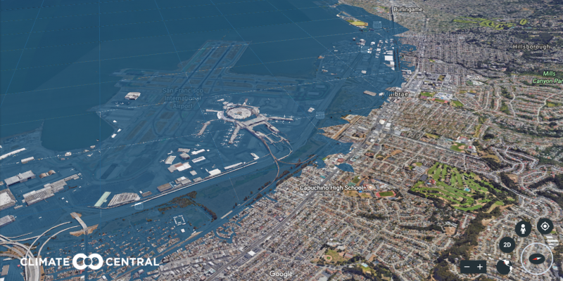
San Francisco International Airport serves over 53 million travelers every year.
In 2100, flyers might have better luck flying into Las Vegas.
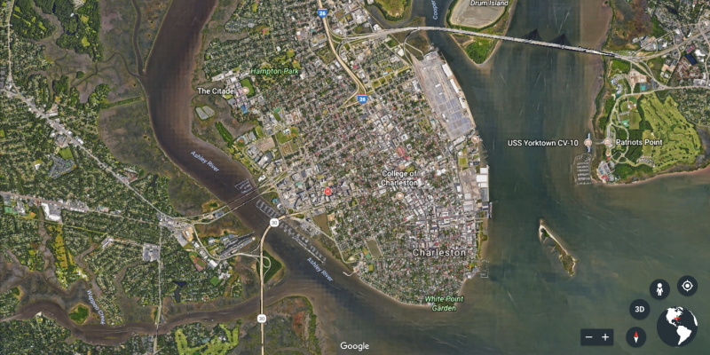
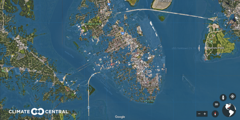
Charleston, South Carolina, already has a flooding problem. The Southern city is flat and at low elevation, which makes it vulnerable to extreme flooding and storm surges.
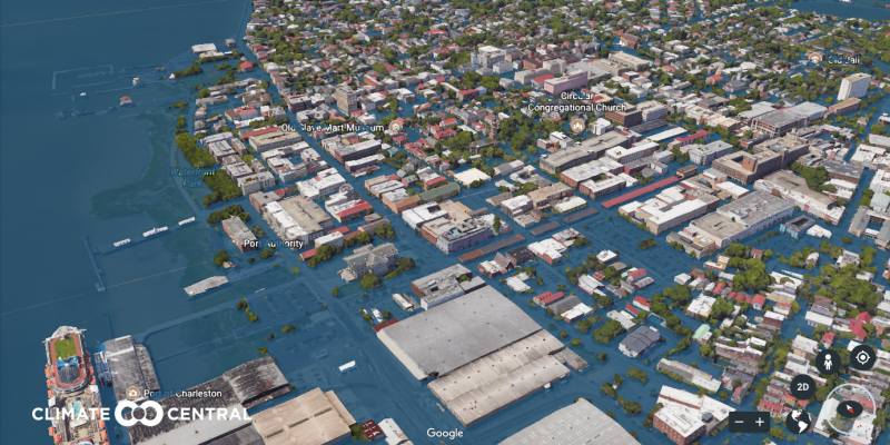
In 2100, you might need a boat to reach the city's center.
Shopping at the Charleston City Market is a must-do for tourists visiting the area.
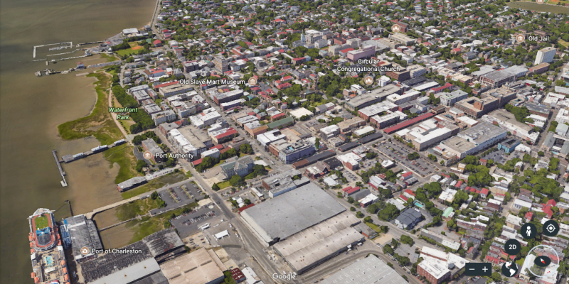
But the long row of red-roofed buildings could be submerged under water by 2100.
Los Angeles, which has the third highest elevation of all major US cities, might fare better.
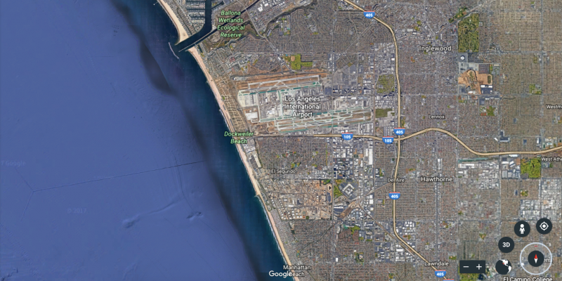
Source: US Geological Survey
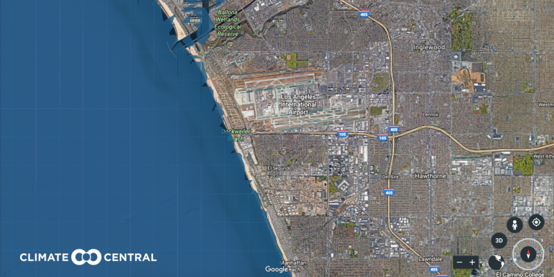
The projections show the Pacific Ocean climbing up the boardwalk, but that's about it.
New Orleans is no stranger to the problems that come along with sea level rise.
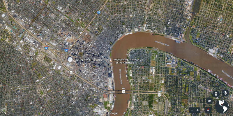
By 2100, The Big Easy could disappear under water. An estimated 500,000 people will have to leave the area in the next century in order to stay above ground.
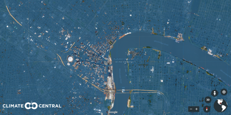
Source: NOLA.com
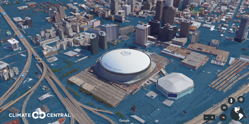
After flooding caused by Hurricane Katrina destroyed 80% of homes in the New Orleans area, tens of thousands of people sought refuge at the Mercedes-Benz Superdome.
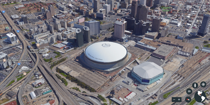
But the arena used as a "shelter of last resort" might not survive extreme sea level rise.
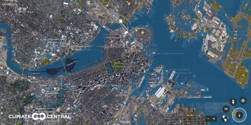
Boston is the only state capital in the continental US that borders an ocean. Extreme sea level rise could cause the Charles River to overflow and spill onto city streets.
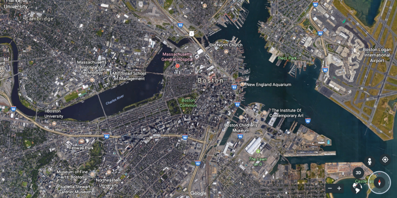
Here's what Boston might look like in the year 2100. Massachusetts General Hospital would have to be abandoned, while Boston Public Garden would be soaked through.
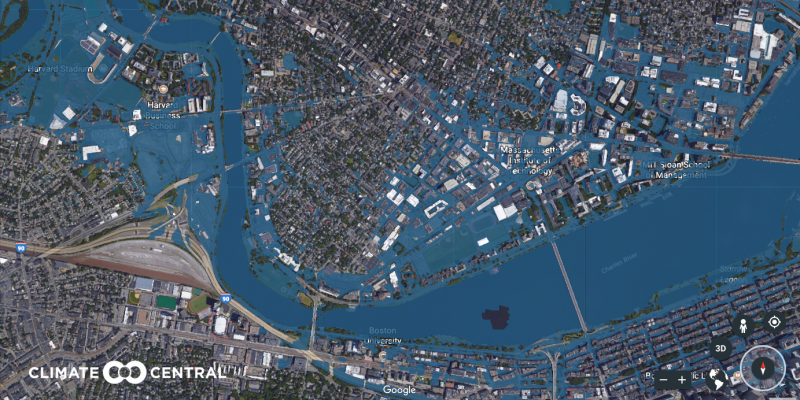
Many of the country's top universities sit along Boston's Charles River.
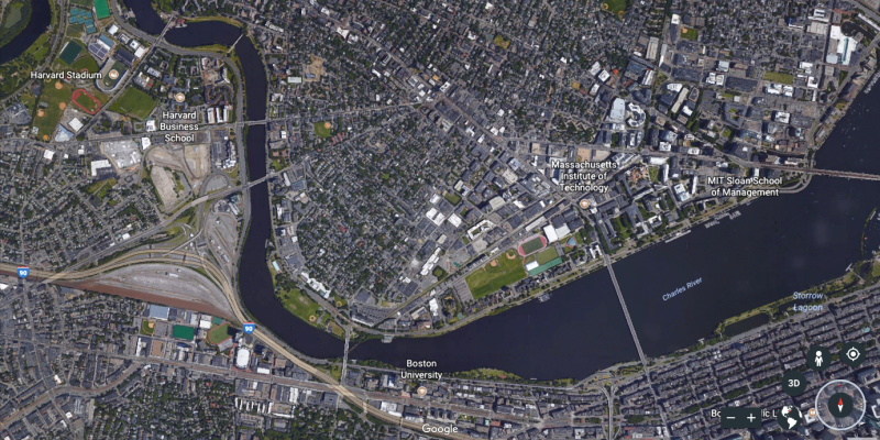
The education world could say goodbye to the Harvard Business School, Boston University, Massachusetts Institute of Technology, and Northeastern University, among others.
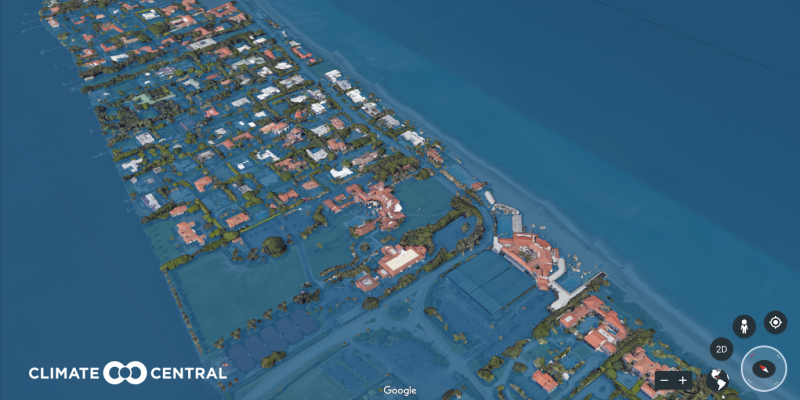
President Trump has spent a decent part of his presidency in Palm Beach, Florida.
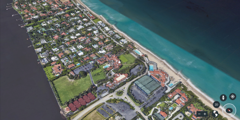
Source: Business Insider
He owns the Mar-a-Lago luxury resort and club, better known as the "Winter White House."
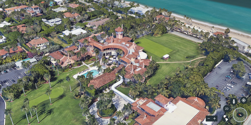
If sea levels rose by as much as 12 feet, the Mar-a-Lago estate would not fare well.
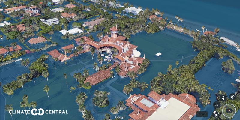
But Trump will be out of office by the time anything like that happens.