- University of New Hampshire’s autonomous boat, Bathymetric Explorer and Navigator (BEN), finds lost shipwrecks.
- BEN maps the ocean floor in spots that are too shallow or dangerous for divers or traditional ships.
- BEN has also been involved in the search to find what happened to Amelia Earhart.
- Visit Business Insider’s homepage for more stories.
This bright yellow autonomous boat might be the key to unlocking the ocean’s secrets. Built by researchers at the University of New Hampshire, the Bathymetric Explorer and Navigator is more affectionately called BEN.
The self-driving boat is used to map the ocean floor, and can assist crews in finding long-lost wrecks, like the famous Ohio in Lake Huron, as The Verge reported. BEN has been involved in other recent searches, and mapping the ocean floor can help improve understanding of the ocean and climate in other ways, too.
Here’s what BEN looks like.
Autonomous surface vehicles like BEN are used to gather data that divers and ships with crews can’t reach.

Foto: BEN self-driving boat. Source: University of New Hampshire
It sends information back to the control room in the trailer on shore.

Foto: BEN self-driving boat. Source: University of New Hampshire
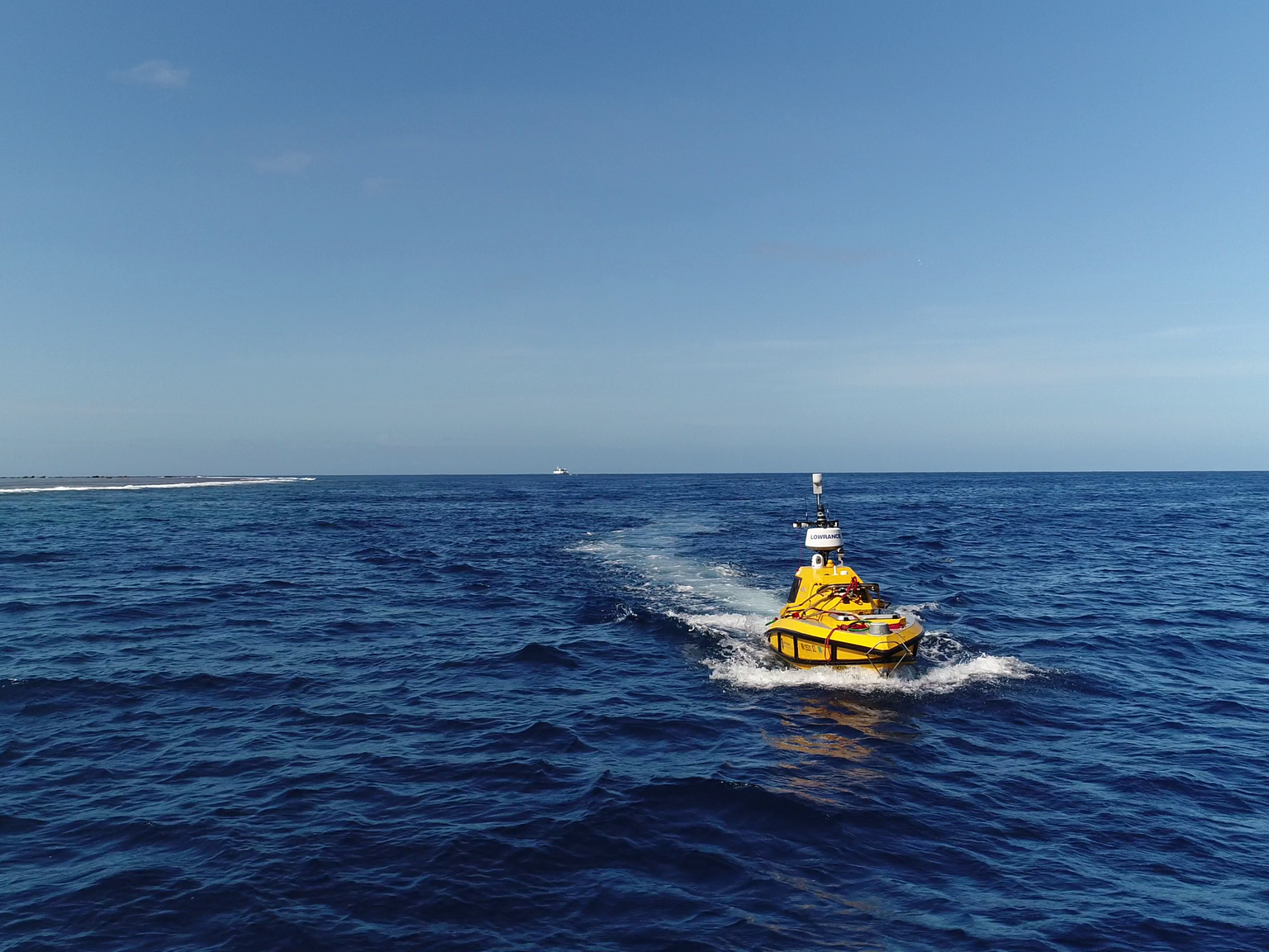
BEN is bright yellow, and about 13 feet long. It can travel for about 16 hours before needing to refuel.

Foto: BEN self-driving boat. Source: University of New Hampshire
In August, BEN set out to find answers to the disappearance of pilot Amelia Earhart in 1937.

Foto: BEN self-driving boat. Source: University of New Hampshire
The first woman to fly solo over the Atlantic, Amelia Earhart sent her last radio signals from somewhere over the Pacific in 1937 during an attempted world flight.

Foto: Amelia Earhart. Source: Getty Images
BEN and the research vessel EV Nautilus went out to look for information on the ocean floor that might give insight about what happened to Earhart.

Foto: BEN self-driving boat. Source: National Geographic
BEN was lowered into the water near the tiny island Nikumaroro in the South Pacific, about halfway between New Guinea and Hawaii.

Foto: BEN self-driving boat. Source: National Geographic
Mapping the ocean floor is expensive and labor intensive, and scientists estimate we’ve only mapped 9% of the total area.

Foto: BEN self-driving boat. Source: National Geographic
Source: MDPI
Equipment on BEN will collect data to create 3D topographic maps of the ocean floor.
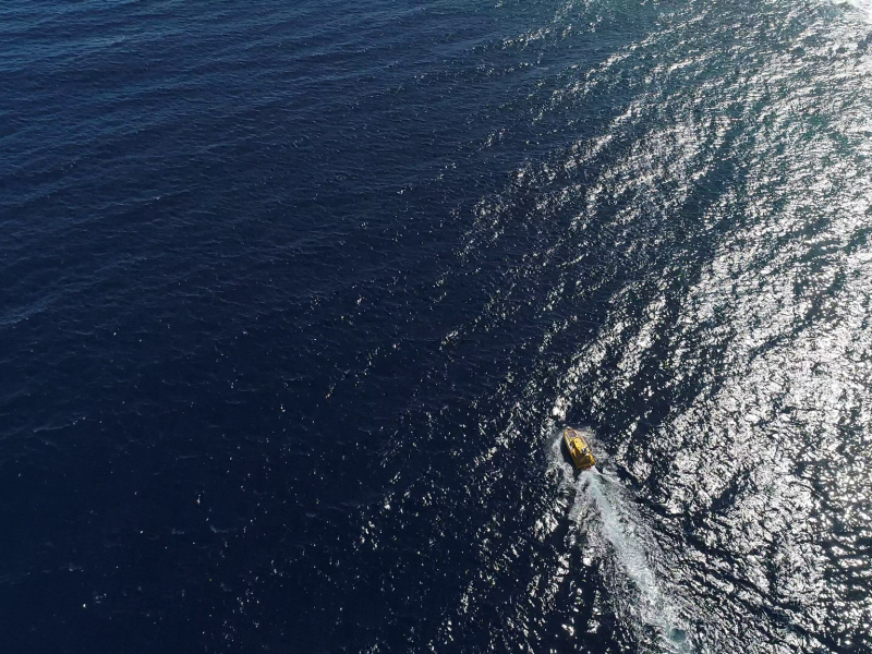
Foto: BEN self-driving boat. Source: National Geographic
Scientists think better knowledge of the ocean floor could help us understand climate change, improve safety at sea, and make it easier to create deep sea cables.

Foto: BEN self-driving boat. Source: University of New Hampshire
The crew of the Nautilus will use that data to target dives and hopefully find evidence from Earhart's flight.

Foto: BEN self-driving boat. Source: National Geographic
A National Geographic camera crew accompanied the expedition this summer...
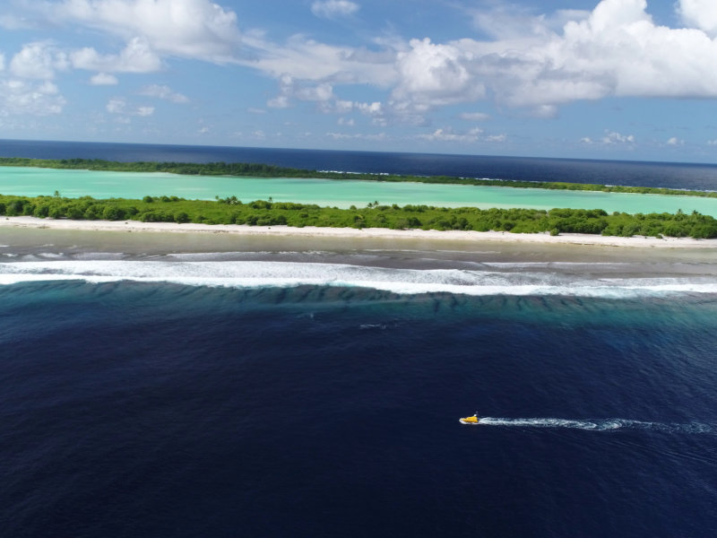
Foto: BEN self-driving boat. Source: National Geographic
...and took some of these stunning photos of BEN off the coast of Nikumaroro. The crew searched for two weeks, but didn't find evidence of Earhart's plane.
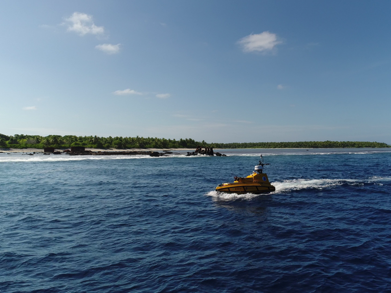
Foto: BEN self-driving boat. Source: National Geographic
BEN has been on other research expeditions, too.

Foto: BEN self-driving boat. Source: University of New Hampshire
These photos are from a mission in Pago Pago Harbor in American Samoa.

Foto: BEN self-driving boat. Source: University of New Hampshire
BEN was also used in Lake Huron's Thunder Bay, sometimes called "Shipwreck Alley" for its history of disastrous wrecks.
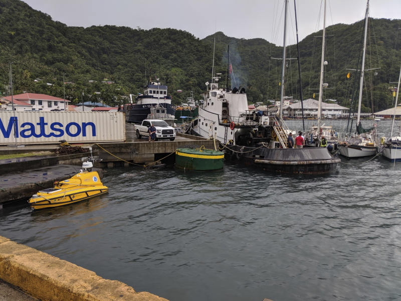
Foto: BEN self-driving boat. Source: University of New Hampshire
Source: The Verge