Before San Francisco was a bustling tech hub, before it was the center of the hippie universe, and before it became known for its lush hills, much of the area was covered in sand dunes.
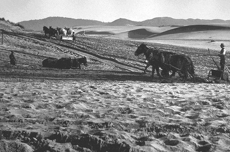
Golden Gate Park, the 1,000-acre green space south of the famous bridge, is located on what was once the largest sand dune ecosystem in the western hemisphere. These dunes spanned seven miles, essentially the entire width of modern-day San Francisco.
About two square miles of dunes still exist today, but the Bay Area has evolved a great deal since then.
Take a look at the maps, paintings, and historical photographs that show the journey of San Francisco.
San Francisco’s first residents, members of the Yelamu tribe, began inhabiting the area around 3000 BC. Approximately 150 to 300 people lived in the boundaries of modern-day San Francisco, though they also roamed to neighboring sites.
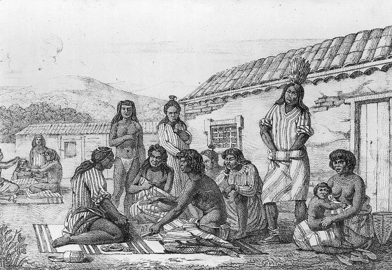
Source: San Francisco Chronicle
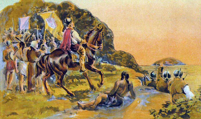
A group of Spanish explorers, led by Don Gaspar de Portolà, arrived there in 1769. This was the first documented European visit to the San Francisco Bay.
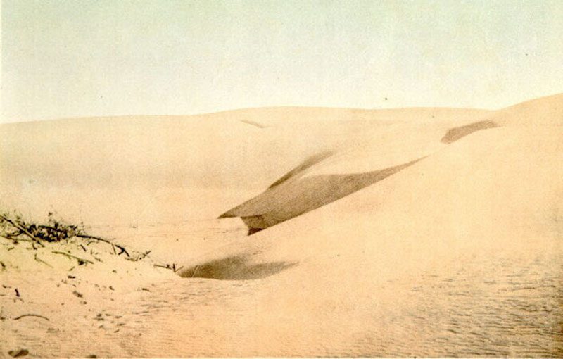
At the time, sand dunes stretched for about seven miles from east to west.

Source: San Francisco Department of the Environment
Here's another early 20th century photo of sand dunes, which formed centuries prior, in what is now the 1,000-acre Golden Gate Park:
The Spanish settlers established the Presidio of San Francisco (i.e. the "Royal Fortress of Saint Francis") in 1776.
The same year, the Mission San Francisco de Asís, the oldest surviving structure in the city, was built. The Catholic church was made of adobe, brush, and wood, which weren't the best materials considering California's earthquakes. Here it is in an 1863 photograph:

The Mission church was part of a complex of buildings, used for housing, agriculture, and manufacturing.
The area remained under Spanish rule until 1821, when it became a part of Mexico.
In 1835, English entrepreneur William Richardson founded the city’s first homestead outside Mission San Francisco de Asís, near what is today Portsmouth Square (a one-block park in the city's Chinatown neighborhood).

Source: San Francisco Gate
The same year, Richardson and Alcalde Francisco de Haro, a Mexican soldier, laid out an urban plan for a larger town, named Yerba Buena (“Good Herb” in Spanish) after an aromatic plant native to the area. The town began to attract American settlers.

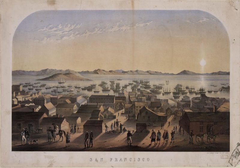
A decade later, Yerba Buena had doubled in population to nearly 1,000 residents, and the town’s name was changed to San Francisco.

Source: "The San Francisco Bay Area"
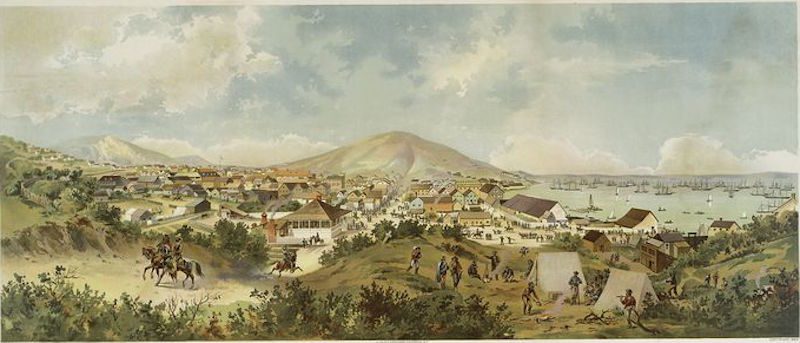
In 1849, San Francisco became the home base for the gold rush, cementing it as a center for maritime trade.
Source: History.com
During the Civil War, San Francisco planned to employ the USS Camanche, pictured below, to defend the West Coast. But the ship sank during a heavy storm in the city's port before it ever saw action. Workers reassembled the ship, which laid decommissioned and later was used to carry coal in the area until 1920s.

Source: The California Historical Society Quarterly
San Francisco has always been vulnerable to earthquakes. In 1868, a quake with an estimated magnitude of 6.8 to 7.0 tilted these row homes.

Source: United States Geological Survey
Another huge earthquake and fire devastated the city in 1906. Here's a photo of the wreckage of San Francisco's City Hall:

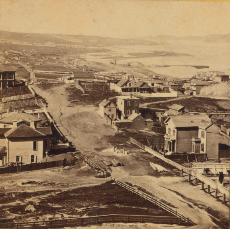
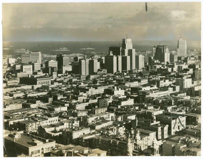
Over the next few decades, San Francisco rebuilt itself ...

... and its population boomed.
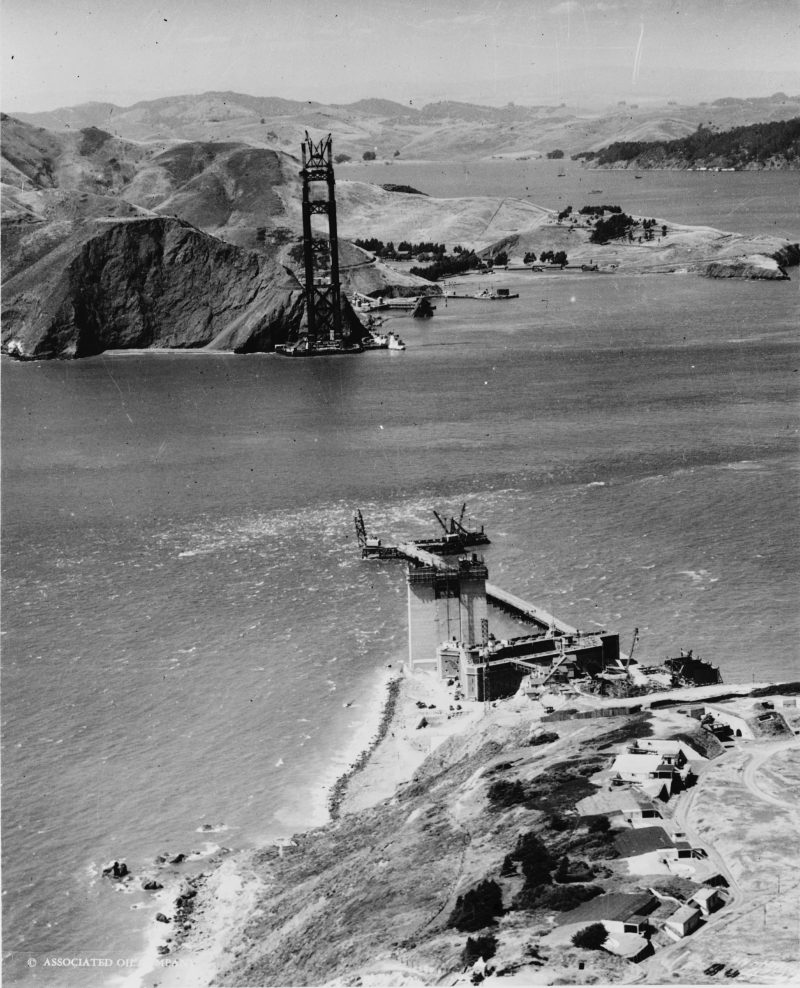
Construction on the 1.7-milelong Golden Gate Bridge began in 1933.
Throughout the first half of the 20th century, the city built up its infrastructure. Here’s a 1945 photo of a street with the city’s earliest streetcars, which debuted in 1873.
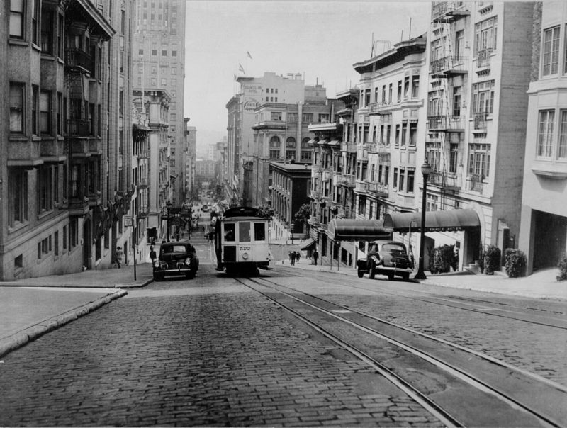
Source: San Francisco Cable Car Museum
The promise of San Francisco's bohemia, cool summers ...
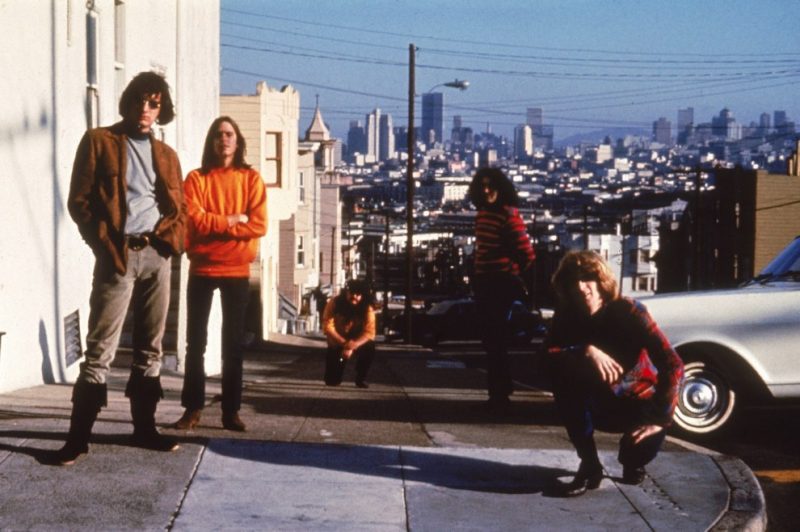
... and the beautiful bay brought more residents to the city.
Today, San Francisco is home to over 800,000 people.

Source: Bay Area Census